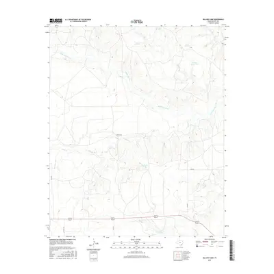
2016 Map of Ballard Camp
USGS Topo · Published 2016About this map
Middle Pease River meanders across this West Texas landscape, defining a terrain shaped by deep seasonal drainages and cattle ranching infrastructure. The settlement of Ballard Camp sits centrally near the confluence of Ballard Cr and Longs Br, illustrating the historical importance of reliable water access in Motley County. The map documents an extensive network of stock tanks, such as Yearling Pasture Tank, Phone Line Tank, and Dry Section Tank, which are vital to the local livestock economy. Further south, the terrain descends toward Hackberry Cr and Tee Pee Cr, while a grid of county roads including Co RD 439 and Co RD 247 provides the primary transit routes through this ranchland.
Find a feature on this map
16 named features on this map. Tap any name to fly to it.
Don’t see what you’re looking for? This feature index may not catch every label — zoom into the map to look around manually.
Map Details
Editions of this 2016 Ballard Camp Map
This is the sole edition of this map. No revisions or reprints were ever made.
Other maps of this area

1954 · Lubbock
USGS Topo · 1:250,000

1954 · Plainview
USGS Topo · 1:250,000

1958 · Plainview
USGS Topo · 1:250,000

1966 · Fields Canyon
USGS Topo · 1:24,000

1966 · Matador
USGS Topo · 1:24,000

1966 · Ballard Camp
USGS Topo · 1:24,000

1966 · Tee Pee City
USGS Topo · 1:24,000

1967 · Hornica Creek
USGS Topo · 1:24,000

1967 · Turtle Hole Camp
USGS Topo · 1:24,000

1968 · Roaring Springs
USGS Topo · 1:24,000