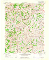
1961 Map of Ballardsville
USGS Topo · Published 1962About this map
Ballardsville anchors a rolling agricultural landscape in the early 1960s, situated near the intersection of the Oldham and Shelby county lines. This region is characterized by a dense network of watercourses, including the Curry Fork and Bullskin Creek, which define the drainage patterns across the terrain. Small rural settlements and crossroads communities like Chestnut Grove and Todds Point serve as local focal points, supported by social infrastructure such as the Ballardsville School and Fairview Church.
Find a feature on this map
27 named features on this map. Tap any name to fly to it.
Don’t see what you’re looking for? This feature index may not catch every label — zoom into the map to look around manually.
Map Details
Editions of this 1961 Ballardsville Map
3 editions found
Other maps of this area

1923 · Waddy
USGS Topo · 1:48,000

1925 · Mount Eden
USGS Topo · 1:48,000

1927 · Mount Eden
USGS Topo · 1:62,500

1928 · New Castle
USGS Topo · 1:48,000

1929 · Taylorsville
USGS Topo · 1:62,500

1932 · New Castle
USGS Topo · 1:62,500

1932 · La Grange
USGS Topo · 1:62,500

1951 · Crestwood
USGS Topo · 1:24,000

1951 · Fisherville
USGS Topo · 1:24,000

1954 · Ballardsville
USGS Topo · 1:24,000