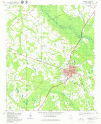
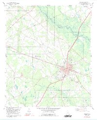
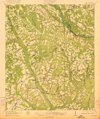
1979 Map of Bamberg
USGS Topo · Published 1980About this map
The County Courthouse and industrial infrastructure of Bamberg anchor this late-1970s landscape, where the Southern and Seaboard Coast Line railroads intersect to define the region's transport corridor. To the west, the settlement of Denmark and the smaller locality of Finland mark the agricultural uplands. The terrain is deeply influenced by the South Fork Edisto River and its associated wetlands, including Roberts Swamp and Snake Swamp. Significant local institutions are visible throughout the town center, most notably the Carlisle Military Sch and Bamberg-Ehrhardt High Sch. Rural life is evidenced by a network of community landmarks like Springtown Ch, Zion Hill Cem, and the Lemon Swamp Ch, while several Strip Mines and Sandpits indicate the extraction activities occurring near Gannts Bay and the river banks.
Find a feature on this map
45 named features on this map. Tap any name to fly to it.
Don’t see what you’re looking for? This feature index may not catch every label — zoom into the map to look around manually.
Map Details
Editions of this 1979 Bamberg Map
2 editions found
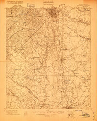
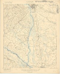
Other maps of this area

1919 · Olar
USGS Topo · 1:62,500

1919 · Bamberg
USGS Topo · 1:48,000

1919 · Lodge
USGS Topo · 1:62,500

1920 · Lodge
USGS Topo · 1:48,000

1920 · Bamberg
USGS Topo · 1:62,500
1920 · Orangeburg
USGS Topo · 1:48,000
1921 · Orangeburg
USGS Topo · 1:62,500
1921 · Lodge
USGS Topo · 1:62,500

1943 · Olar
USGS Topo · 1:62,500
1943 · Lodge
USGS Topo · 1:62,500