
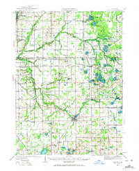
1927 Map of Bangor
USGS Topo · Published 1959About this map
Bangor serves as the focal point of this southwestern Michigan landscape, situated where the Black River meets the Mill Pond. The map reveals a highly developed rural structure from the late 1920s, characterized by a dense network of country schoolhouses such as Arlington Center School, Beechdale School, and Garden of Eden School. This distribution suggests a closely knit agrarian society with small school districts serving local farmsteads.
Find a feature on this map
102 named features on this map. Tap any name to fly to it.
Don’t see what you’re looking for? This feature index may not catch every label — zoom into the map to look around manually.
Map Details
Editions of this 1927 Bangor Map
2 editions found
Other maps of this area

1927 · Hartford
USGS Topo · 1:62,500

1927 · Benton Harbor
USGS Topo · 1:62,500

1927 · South Haven
USGS Topo · 1:62,500

1928 · Fennville
USGS Topo · 1:62,500

1930 · South Haven
USGS Topo · 1:62,500

1930 · Benton Harbor
USGS Topo · 1:62,500

1931 · Fennville
USGS Topo · 1:62,500

1931 · Bangor
USGS Topo · 1:62,500

1931 · Hartford
USGS Topo · 1:62,500

1943 · South Haven
USGS Topo · 1:62,500