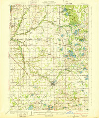
1931 Map of Bangor
USGS Topo · Published 1931About this map
The Pere Marquette railroad anchors the interior of this Southwest Michigan landscape, connecting agricultural hubs like Bangor and Grand Junction. This early 20th-century survey reveals a dense network of rural infrastructure, from the lakeside retreats at Glenn Shores to the numerous neighborhood schoolhouses such as Garden of Eden Sch and Evergreen Glade Sch. The land is defined by its transition from the Lake Michigan shoreline in the west to the lake-studded interior of Columbia and Bangor townships. Inland, water bodies like Saddle Lake and Lester Lake are surrounded by a tapestry of small settlements and places of worship, including the curiously named Gingerbread Ch. The placement of Coburn Cem and various family-named landmarks such as Chambers Corner provides critical data for genealogists tracing the early development of Allegan and Van Buren counties before modern highway expansion.
Find a feature on this map
112 named features on this map. Tap any name to fly to it.
Don’t see what you’re looking for? This feature index may not catch every label — zoom into the map to look around manually.
Map Details
Editions of this 1931 Bangor Map
3 editions found
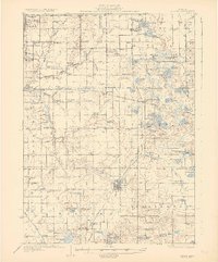
Other maps of this area

1927 · Hartford
USGS Topo · 1:62,500

1927 · Bangor
USGS Topo · 1:62,500

1927 · Benton Harbor
USGS Topo · 1:62,500

1927 · South Haven
USGS Topo · 1:62,500

1928 · Fennville
USGS Topo · 1:62,500

1930 · South Haven
USGS Topo · 1:62,500

1930 · Benton Harbor
USGS Topo · 1:62,500

1931 · Fennville
USGS Topo · 1:62,500

1931 · Bangor
USGS Topo · 1:62,500

1931 · Hartford
USGS Topo · 1:62,500