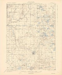
1931 Map of Bangor
USGS Topo · Published 1931About this map
The Pere Marquette railroad anchors the local economy of this Van Buren County landscape, connecting agricultural shipping points like Bangor and Grand Junction. Inland from the Lake Michigan shoreline at Glenn Shores, the terrain is defined by a dense network of early 20th-century rural schools such as Hawkhead and Hadaway Sch, serving a community of farmsteads and small fruit-growing settlements. The Michigan Base Line divides the territory, while the Black River and its Middle Fork wind through townships like Casco and Geneva. A high concentration of small kettle lakes, including Saddle Lake and Osterhout Lake, provided localized recreational hubs alongside historic landmarks like Kibbie Chapel and the distinctively named Gingerbread Ch. Local surveyors C.P.McKinley and R.A.Kiger mapped this area just before the widespread modernization of the road network, preserving the layout of crossroads like Chambers Corner and Arlington Center.
Find a feature on this map
125 named features on this map. Tap any name to fly to it.
Don’t see what you’re looking for? This feature index may not catch every label — zoom into the map to look around manually.
Map Details
Editions of this 1931 Bangor Map
3 editions found
Other maps of this area

1927 · Hartford
USGS Topo · 1:62,500

1927 · Bangor
USGS Topo · 1:62,500

1927 · Benton Harbor
USGS Topo · 1:62,500

1927 · South Haven
USGS Topo · 1:62,500

1928 · Fennville
USGS Topo · 1:62,500

1930 · South Haven
USGS Topo · 1:62,500

1930 · Benton Harbor
USGS Topo · 1:62,500

1931 · Fennville
USGS Topo · 1:62,500

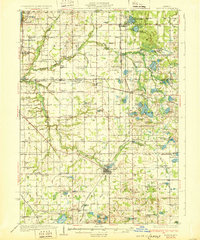
1931 · Bangor
USGS Topo · 1:62,500

1931 · Hartford
USGS Topo · 1:62,500