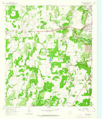
1962 Map of Bangs East
USGS Topo · Published 1964About this map
The western edges of Brownwood and the small town of Bangs dominate this early 1960s landscape, where the oil industry and military history converge. The Brownwood Oil Field marks the eastern half of the map, characterized by numerous wells and the Camp Bowie Military Reservation occupying the southeastern corner. Transportation is defined by the Gulf Colorado and Santa Fe railroad, while an Old Railroad Grade suggests earlier infrastructure that once served this central Texas region.
Find a feature on this map
22 named features on this map. Tap any name to fly to it.
Don’t see what you’re looking for? This feature index may not catch every label — zoom into the map to look around manually.
Map Details
Editions of this 1962 Bangs East Map
3 editions found
Other maps of this area

1887 · Coleman
USGS Topo · 1:125,000

1889 · Brownwood
USGS Topo · 1:125,000

1889 · Coleman
USGS Topo · 1:125,000

1894 · Brownwood
USGS Topo · 1:125,000

1924 · Brownwood Reservoir Site
USGS Topo · 1:48,000

1925 · Brownwood 3-b
USGS Topo · 1:48,000

1927 · Grosvenor
USGS Topo · 1:62,500

1928 · Zephyr
USGS Topo · 1:62,500

1950 · Zephyr
USGS Topo · 1:62,500

1954 · Brownwood
USGS Topo · 1:250,000