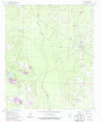
1973 Map of Banks
USGS Topo · Published 1986About this map
Moro Creek serves as the natural boundary between Calhoun and Bradley counties, anchoring a landscape of timbered lowlands and small agricultural settlements in south-central Arkansas. The Warren and Ouachita Valley RR intersects the town of Banks, which stands as the primary hub for the surrounding rural communities of Lanark and Summerville. Historical transit patterns are visible through the Old Railroad Grade and the Fordyce and Princeton Road, reflecting the region's reliance on rail and early road networks to move resources through the Ouachita Valley.
Find a feature on this map
30 named features on this map. Tap any name to fly to it.
Don’t see what you’re looking for? This feature index may not catch every label — zoom into the map to look around manually.
Map Details
Editions of this 1973 Banks Map
2 editions found
Other maps of this area

1934 · Ingalls
USGS Topo · 1:48,000

1934 · Moro Bay
USGS Topo · 1:62,500

1937 · Ingalls
USGS Topo · 1:62,500

1938 · Moro Bay
USGS Topo · 1:62,500

1939 · Moro Bay
USGS Topo · 1:62,500

1939 · Ingalls
USGS Topo · 1:62,500

1953 · El Dorado
USGS Topo · 1:250,000

1957 · El Dorado
USGS Topo · 1:250,000

1958 · El Dorado
USGS Topo · 1:250,000

1960 · El Dorado
USGS Topo · 1:250,000