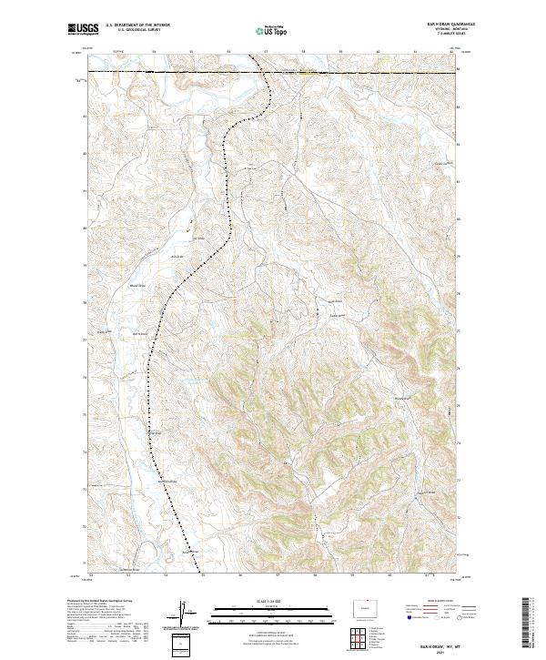
2021 Map of Bar N Draw
USGS Topo · Published 2021About this map
The Tongue River and its complex network of tributaries define the borderlands of Sheridan County, Wyoming, and Big Horn County, Montana. This landscape is a labyrinth of seasonal watercourses and topographic depressions, where family and local ranching history is etched into the terrain via names like Krenzien Draw, Heppner Draw, and Enochs Draw. The reliance on water management in this arid ranching country is evident through infrastructure like Gorman Reservoir Number 2 and the Prairie Dog Ditch Number 13, which divert flow from Prairie Dog Cr to support the surrounding high-plains acreage.
Find a feature on this map
37 named features on this map. Tap any name to fly to it.
Don’t see what you’re looking for? This feature index may not catch every label — zoom into the map to look around manually.
Map Details
Editions of this 2021 Bar N Draw Map
This is the sole edition of this map. No revisions or reprints were ever made.
Other maps of this area

1909 · Sheridan
USGS Topo · 1:125,000

1911 · Sheridan
USGS Topo · 1:125,000

1954 · Hardin
USGS Topo · 1:250,000

1955 · Sheridan
USGS Topo · 1:250,000

1957 · Hardin
USGS Topo · 1:250,000

1958 · Hardin
USGS Topo · 1:250,000

1958 · Sheridan
USGS Topo · 1:250,000

1962 · Sheridan
USGS Topo · 1:250,000

1967 · Holmes Ranch
USGS Topo · 1:24,000
1967 · Pearl School
USGS Topo · 1:24,000