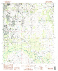
1987 Map of Barachias
USGS Topo · Published 1987About this map
Montgomery expands southward toward the Corporate Limits in this late 1980s provisional study, showing the suburban growth of the Alabama capital. The landscape is a mix of developing residential areas like Pinedale and older rural settlements such as Barachias and Macedonia. Family history and local heritage are well-preserved through numerous burial grounds, including the Green Cem, Flora Cem, and the Jackson Prospect Ch Cem located near the southern edge. The terrain is defined by the winding course of Catoma Creek and Whites Slough, which influence the local road network. Educational and religious landmarks are densely plotted, from the Montgomery Catholic High Sch to country churches like Harmony Ch and Pine Grove Ch. Evidence of earlier local industry remains at Perrys Mill along the Southern railroad line, while modern infrastructure is represented by the CSX rail corridor.
Find a feature on this map
46 named features on this map. Tap any name to fly to it.
Don’t see what you’re looking for? This feature index may not catch every label — zoom into the map to look around manually.
Map Details
Editions of this 1987 Barachias Map
2 editions found
Other maps of this area

1927 · Montgomery
USGS Topo · 1:48,000

1930 · Montgomery
USGS Topo · 1:62,500

1953 · Montgomery
USGS Topo · 1:250,000

1956 · Montgomery
USGS Topo · 1:250,000

1957 · Montgomery
USGS Topo · 1:250,000

1957 · Letohatchee
USGS Topo · 1:62,500

1958 · Montgomery
USGS Topo · 1:62,500

1958 · Montgomery North
USGS Topo · 1:24,000

1958 · Montgomery South
USGS Topo · 1:24,000

1958 · Mount Meigs
USGS Topo · 1:62,500