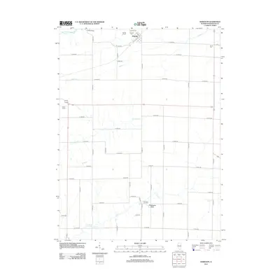
2012 Map of Bardolph
USGS Topo · Published 2012About this map
Bardolph and the settlement at Pennington Point anchor this rural landscape in McDonough County, defined by a highly organized section-line road grid and several winding waterways. The E Fork La Moine River clips the northwest corner near Holler Bridge, while Kepple Cr, Troublesome Cr, and Camp Cr snake through the agricultural fields, occasionally disrupting the otherwise rigid path of routes like N 1150th Rd. Genealogists will find several burial sites preserved among the farms, including Bardolph Cem, Mound Cem, and Pennington Point Cem. Local aviation is represented by two small airstrips, Palmer Airport and Smith Airport, which serve this sparsely populated region. The map captures a moment in the early 21st century where the primary infrastructure remains focused on transport and agriculture, with most activity concentrated along the north-south corridors like E 1700th St.
Find a feature on this map
41 named features on this map. Tap any name to fly to it.
Don’t see what you’re looking for? This feature index may not catch every label — zoom into the map to look around manually.
Map Details
Editions of this 2012 Bardolph Map
This is the sole edition of this map. No revisions or reprints were ever made.
Other maps of this area

1912 · Macomb
USGS Topo · 1:62,500

1914 · Macomb
USGS Topo · 1:62,500

1915 · Avon
USGS Topo · 1:62,500

1916 · Good Hope
USGS Topo · 1:62,500

1918 · Vermont
USGS Topo · 1:62,500

1918 · Good Hope
USGS Topo · 1:62,500

1921 · Vermont
USGS Topo · 1:62,500

1944 · Avon
USGS Topo · 1:62,500

1947 · Vermont
USGS Topo · 1:24,000

1947 · Adair
USGS Topo · 1:24,000