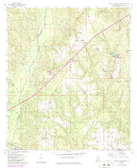
1960 Map of Barnett Crossroads
USGS Topo · Published 1986About this map
Barnett Crossroads and Stanley Crossroads anchor this landscape of the Escambia River basin as it appeared in the late 1950s and early 1960s. The terrain is defined by the winding course of Big Escambia Creek, which is fed by numerous tributaries including Broken Leg Creek and Hall Creek. The map documents a rural network of community life centered on country churches such as New Bethlehem Ch, Gravel Hill Ch, and Magnolia Ch.
Find a feature on this map
24 named features on this map. Tap any name to fly to it.
Don’t see what you’re looking for? This feature index may not catch every label — zoom into the map to look around manually.
Map Details
Editions of this 1960 Barnett Crossroads Map
3 editions found
Other maps of this area

1953 · Andalusia
USGS Topo · 1:250,000

1957 · Andalusia
USGS Topo · 1:250,000

1960 · Atmore
USGS Topo · 1:24,000

1960 · Huxford
USGS Topo · 1:24,000

1960 · Pollard
USGS Topo · 1:24,000

1960 · Barnett Crossroads
USGS Topo · 1:24,000

1960 · Wallace
USGS Topo · 1:24,000
1960 · Flomaton
USGS Topo · 1:24,000

1971 · Range
USGS Topo · 1:24,000

1972 · Frisco City SE
USGS Topo · 1:24,000