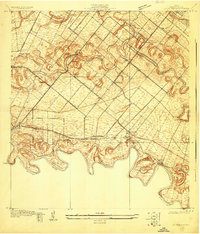
1936 Map of Barreda
USGS Topo · Published 1936About this map
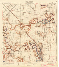
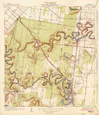
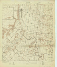
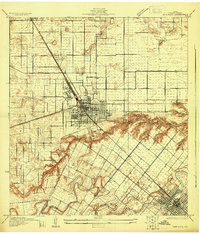
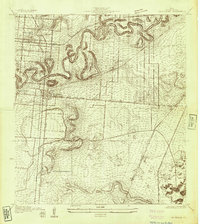
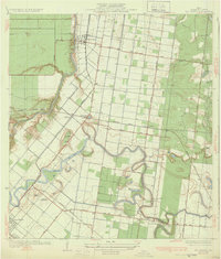
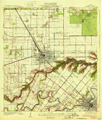
The winding oxbow lakes known as resacas dominate this Lower Rio Grande Valley landscape, illustrating the ancient shifts of the Rio Grande before modern water management. The elaborate loops of Resaca de los Cuates and Resaca del Rancho Viejo provide the topographic framework for early 20th-century agriculture, where the Olmito North Canal and the Second Lift Pumping Sta signal the expansion of irrigation.
Find a feature on this map
36 named features on this map. Tap any name to fly to it.
Don’t see what you’re looking for? This feature index may not catch every label — zoom into the map to look around manually.
Map Details
Editions of this 1936 Barreda Map
2 editions found
Other maps of this area
1929 · Rio Hondo
USGS Topo · 1:24,000
1929 · Harlingen
USGS Topo · 1:24,000
1929 · La Paloma
USGS Topo · 1:24,000
1930 · Los Fresnos
USGS Topo · 1:24,000

1930 · West Brownsville
USGS Topo · 1:24,000

1930 · Barreda
USGS Topo · 1:24,000

1930 · Laguna Atascosa
USGS Topo · 1:24,000

1930 · East Brownsville
USGS Topo · 1:24,000
1932 · Rio Hondo
USGS Topo · 1:31,680
1932 · Harlingen
USGS Topo · 1:31,680