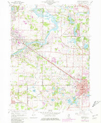
1960 Map of Barrington
USGS Topo · Published 1981About this map
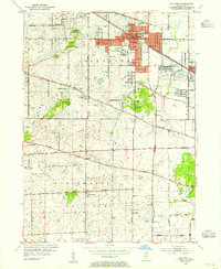
The Fox River carves a path through this landscape, anchoring a series of mid-century communities including Oakwood Hills, Fox River Valley Gardens, and Fox River Grove. The area’s development is clearly defined by the Chicago and North Western railroad corridor, which links the growing village of Barrington to the surrounding townships. In the southern half, the Spring Creek Valley Forest Preserve offers a large expanse of undeveloped land, contrasting with the many private lakes and golf courses that characterize the suburban expansion into Lake Barrington and Barrington Hills. Researchers can find numerous institutional landmarks, from Bellarmine Hall to several historic burial grounds like White Cem and Evergreen Cem. The map's purple revisions indicate significant post-1960 suburban growth, particularly around Carpentersville and the various country clubs.
Find a feature on this map
75 named features on this map. Tap any name to fly to it.
Don’t see what you’re looking for? This feature index may not catch every label — zoom into the map to look around manually.
Map Details
Editions of this 1960 Barrington Map
4 editions found
Other maps of this area

1920 · Grays Lake
USGS Topo · 1:62,500

1923 · Grays Lake
USGS Topo · 1:62,500

1923 · Barrington
USGS Topo · 1:62,500

1925 · Elgin
USGS Topo · 1:62,500

1926 · Mc Henry
USGS Topo · 1:62,500

1935 · Barrington
USGS Topo · 1:62,500

1940 · Elgin
USGS Topo · 1:62,500

1944 · McHenry
USGS Topo · 1:62,500
1953 · Palatine
USGS Topo · 1:24,000

1954 · Rockford
USGS Topo · 1:250,000