
1963 Map of Barrontown
USGS Topo · Published 1964About this map
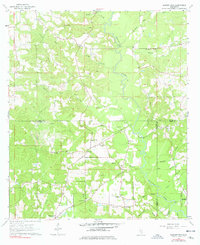
Tallahala Creek dictates the geography of this 1963 survey, winding southward through a landscape defined by the intersection of Jones, Forrest, and Perry Counties. The rural settlement pattern is anchored by local congregations and schools, including Unity Chapel, Macedonia Ch, and the Petal Lookout Tower which overlooks the southern reaches near Barrontown. In the central region, the crossroads at Morriston serves as a local hub near Gillis Creek. The map records a transition toward modern infrastructure with the appearance of gas wells and a Compressor Sta, illustrating the mid-century industrial presence alongside traditional agriculture. Numerous small burial grounds, such as Barlow Cem and Odoms Cem, are located throughout the pine-heavy terrain, offering essential coordinates for genealogical research in this tri-county borderland.
Find a feature on this map
48 named features on this map. Tap any name to fly to it.
Don’t see what you’re looking for? This feature index may not catch every label — zoom into the map to look around manually.
Map Details
Editions of this 1963 Barrontown Map
4 editions found
Other maps of this area

1953 · Hattiesburg
USGS Topo · 1:250,000

1958 · Hattiesburg
USGS Topo · 1:250,000

1964 · Carterville
USGS Topo · 1:24,000

1964 · Ovett SE
USGS Topo · 1:24,000

1964 · Ovett
USGS Topo · 1:24,000

1964 · Ellisville
USGS Topo · 1:24,000

1964 · Hattiesburg
USGS Topo · 1:24,000

1964 · Lanham
USGS Topo · 1:24,000

1965 · Eastabuchie
USGS Topo · 1:24,000

1965 · Moselle
USGS Topo · 1:24,000