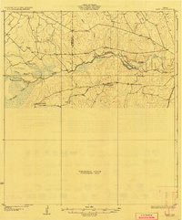
1927 Map of Bart
USGS Topo · Published 1927About this map
The Nueces River serves as the central artery of this South Texas landscape, carving a path through brush country and supporting a series of intermittent water bodies like Harris Lake and Joe Street Lake. Surveyed in the mid-1920s by C.W. Goodlove and others for the Board of Water Engineers, the map reveals a sparsely populated ranching economy defined by large family holdings. Notable among these are Cochina Ranch, Warnberger Ranch, and San Roque Ranch, which anchor the transport network. Roadways like the Kings Highway and Big Wells Road follow the natural contours of the land, connecting the river bottom to the arid uplands. The presence of features such as Sauce Mocho and McDonald Lake illustrates the critical importance of water management and drainage in a region where creeks like Espio Creek and San Roque Creek are often the only markers of reliable moisture.
Find a feature on this map
16 named features on this map. Tap any name to fly to it.
Don’t see what you’re looking for? This feature index may not catch every label — zoom into the map to look around manually.
Map Details
Editions of this 1927 Bart Map
3 editions found
Other maps of this area

1925 · San Roque Lake 1-a
USGS Topo · 1:48,000

1927 · Bart
USGS Topo · 1:62,500

1929 · Cotulla
USGS Topo · 1:125,000

1932 · Valley Wells
USGS Topo · 1:62,500

1939 · Big Wells
USGS Topo · 1:62,500

1940 · Cotulla
USGS Topo · 1:62,500

1940 · Velenzuela Creek
USGS Topo · 1:62,500

1940 · Catarina
USGS Topo · 1:62,500

1940 · Artesia Wells
USGS Topo · 1:62,500

1942 · Dilley
USGS Topo · 1:62,500