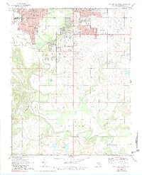
1971 Map of Bartlesville South
USGS Topo · Published 1983About this map
Bartlesville serves as the focal point of this 1971 survey, showing a landscape defined by industrial development and institutional growth. The Caney River meanders through the central terrain, bordered by numerous educational facilities like Wesleyan College and Sooner High School. Heavy infrastructure is evident in the rail networks of the Missouri Kansas Texas and Atchison Topeka and Santa Fe lines, which cut through the urban and rural sectors.
Find a feature on this map
40 named features on this map. Tap any name to fly to it.
Don’t see what you’re looking for? This feature index may not catch every label — zoom into the map to look around manually.
Map Details
Editions of this 1971 Bartlesville South Map
3 editions found
Other maps of this area

1901 · Nowata
USGS Topo · 1:125,000

1909 · Pawhuska
USGS Topo · 1:125,000

1910 · Pawhuska
USGS Topo · 1:125,000

1914 · Nowata
USGS Topo · 1:125,000

1954 · Tulsa
USGS Topo · 1:250,000

1955 · Enid
USGS Topo · 1:250,000

1958 · Enid
USGS Topo · 1:250,000

1958 · Tulsa
USGS Topo · 1:250,000

1963 · Tulsa
USGS Topo · 1:250,000

1970 · Bartlesville SE
USGS Topo · 1:24,000