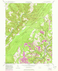
1947 Map of Barton
USGS Topo · Published 1982About this map
Barton and the industrial corridor of Georges Creek define the eastern edge of this landscape, where the Western Maryland railroad served a string of mining and milling towns including Moscow, Nikep, and Morrison. Rising sharply to the west, the massive bulk of Big Savage Mountain and the Savage River State Forest dominate the terrain. This transition from the settled coal valley to the high ridges is marked by prominent landmarks like High Rock 2951 Lookout and Michaels 1880. Local spiritual and social life is anchored at Broadwater Chapel, Mt Zion Ch, and St Gabriel Ch. The map captures a moment of continued extractive industry, evidenced by a Strip Mine and the timbered heights around Savage River Lodge.
Find a feature on this map
61 named features on this map. Tap any name to fly to it.
Don’t see what you’re looking for? This feature index may not catch every label — zoom into the map to look around manually.
Map Details
Editions of this 1947 Barton Map
4 editions found
Other maps of this area

1891 · Romney
USGS Topo · 1:125,000

1895 · Piedmont
USGS Topo · 1:125,000

1898 · Frostburg
USGS Topo · 1:62,500

1899 · Grantsville
USGS Topo · 1:62,500

1901 · Frostburg
USGS Topo · 1:62,500

1904 · Grantsville
USGS Topo · 1:62,500

1908 · Frostburg
USGS Topo · 1:62,500

1919 · Elk Garden
USGS Topo · 1:48,000

1920 · Elk Garden
USGS Topo · 1:48,000

1920 · Keyser
USGS Topo · 1:62,500