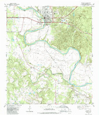
1982 Map of Bastrop
USGS Topo · Published 1986About this map
The Colorado River carves a deep, winding path through this central Texas landscape, creating dramatic geographical features like Haupt Bend and the Red Bluffs. The city of Bastrop sits at a historic crossing point where the Missouri Kansas Texas railroad meets the river, serving as a gateway to the wooded hills of Bastrop State Park to the east. The land south of the city transitions into open prairie, notably Hills Prairie and Crafts Prairie, where a dense network of family cemeteries and rural congregations defines the local heritage.
Find a feature on this map
47 named features on this map. Tap any name to fly to it.
Don’t see what you’re looking for? This feature index may not catch every label — zoom into the map to look around manually.
Map Details
Editions of this 1982 Bastrop Map
3 editions found
Other maps of this area

1885 · Bastrop
USGS Topo · 1:125,000

1893 · Bastrop
USGS Topo · 1:125,000

1901 · Flatonia
USGS Topo · 1:125,000

1904 · Bastrop
USGS Topo · 1:125,000

1948 · Smithville
USGS Topo · 1:62,500

1948 · Bastrop
USGS Topo · 1:62,500

1950 · Bastrop
USGS Topo · 1:62,500

1950 · Smithville
USGS Topo · 1:62,500

1953 · Seguin
USGS Topo · 1:250,000

1954 · Austin
USGS Topo · 1:250,000