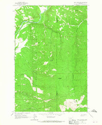
1965 Map of Bata Mountain
USGS Topo · Published 1967About this map
Clearwater State Forest dominates this mountain landscape along the border of Missoula and Powell counties, as it appeared in the mid-1960s. The northern reaches are defined by the winding course of the Blackfoot River, where the Bear Creek Bridge provides a vital crossing point near Bear Creek Flat. This area reflects a legacy of natural resource extraction and high-altitude wilderness, with multiple sites marked simply as Mines or Prospect scattered across the southern ridges near Cap Wallace Gulch.
Find a feature on this map
24 named features on this map. Tap any name to fly to it.
Don’t see what you’re looking for? This feature index may not catch every label — zoom into the map to look around manually.
Map Details
Editions of this 1965 Bata Mountain Map
2 editions found
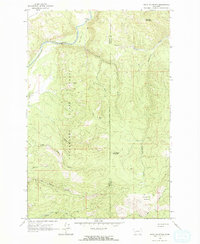
Other maps of this area

1902 · Ovando
USGS Topo · 1:125,000

1905 · Ovando
USGS Topo · 1:125,000

1919 · Drummond
USGS Topo · 1:125,000

1921 · Drummond
USGS Topo · 1:125,000

1947 · Butte
USGS Topo · 1:250,000

1955 · Choteau
USGS Topo · 1:250,000

1957 · Choteau
USGS Topo · 1:250,000

1958 · Butte
USGS Topo · 1:250,000

1958 · Choteau
USGS Topo · 1:250,000

1960 · Butte
USGS Topo · 1:250,000