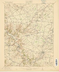
1916 Map of Batavia
USGS Topo · Published 1916About this map
The East Fork Little Miami River carves a winding, deep-cut path across this Clermont County landscape, defining the rural character of southwestern Ohio during the early twentieth century. Extensive rail infrastructure connects the scattered settlements, with the Norfolk and Western RR and several lines of the Electric RR facilitating movement between hubs like Batavia and Williamsburg. The map reveals a high density of rural education, with dozens of family-named schoolhouses such as Spread Eagle School, Sugar Grove School, and De La Palma School serving the farming townships. Settlement patterns follow the river and its many tributaries, including Stonelick Creek and Cloverlick Creek. Near the southern boundary, industrial history is noted at Hennings Mills, while infrastructure landmarks like Twin Bridges highlight the engineering of the era's road network.
Find a feature on this map
115 named features on this map. Tap any name to fly to it.
Don’t see what you’re looking for? This feature index may not catch every label — zoom into the map to look around manually.
Map Details
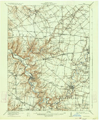
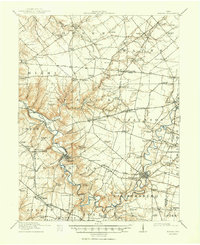
Editions of this 1916 Batavia Map
4 editions found
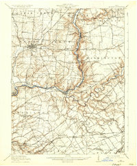
Other maps of this area

1898 · East Cincinnati
USGS Topo · 1:62,500

1904 · Mason
USGS Topo · 1:62,500

1906 · Mason
USGS Topo · 1:62,500

1907 · Blanchester
USGS Topo · 1:62,500

1914 · East Cincinnati
USGS Topo · 1:62,500

1914 · Batavia
USGS Topo · 1:48,000

1914 · Morrow
USGS Topo · 1:62,500

1916 · Batavia
USGS Topo · 1:62,500
1916 · Morrow
USGS Topo · 1:62,500

1917 · Sardinia
USGS Topo · 1:62,500
Featured Places
- Stonelick Township, OH
- Amelia, Batavia Township
- Mulberry, Miami Township
- Williamsburg, Williamsburg Township
- Batavia, Batavia Township