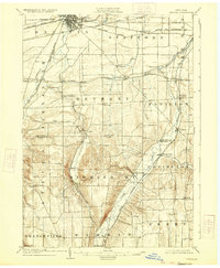
1904 Map of Batavia
USGS Topo · Published 1933About this map
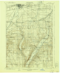
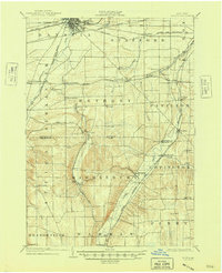
Batavia serves as the industrial and transit anchor for this Genesee County region, where a dense concentration of rail lines converges at the turn of the twentieth century. The map illustrates a complex transportation network, including the New York Central R R, the Lehigh Valley R R, and multiple branches of the Erie R R. These iron arteries connect smaller agricultural hamlets like East Alexander, Pavilion, and Wyoming to the larger regional markets.
Find a feature on this map
54 named features on this map. Tap any name to fly to it.
Don’t see what you’re looking for? This feature index may not catch every label — zoom into the map to look around manually.
Map Details
Editions of this 1904 Batavia Map
7 editions found
Other maps of this area

1897 · Albion
USGS Topo · 1:62,500

1897 · Medina
USGS Topo · 1:62,500

1899 · Brockport
USGS Topo · 1:62,500

1904 · Batavia
USGS Topo · 1:62,500

1904 · Caledonia
USGS Topo · 1:62,500

1905 · Attica
USGS Topo · 1:62,500

1905 · Portage
USGS Topo · 1:62,500

1905 · Nunda
USGS Topo · 1:62,500

1923 · Arcade
USGS Topo · 1:62,500

1925 · Arcade
USGS Topo · 1:62,500