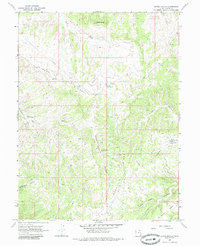
1966 Map of Bates Knolls
USGS Topo · Published 1985About this map
Seep Ridge dominates this high-plateau landscape in Uintah County, showing a remote region defined by ephemeral water management and early energy infrastructure. In the mid-1960s, the terrain was marked by a series of isolated catchments including Sunday School Reservoir, McCoy Reservoir No 1, and Jims Reservoir, which provided essential water in an arid environment. The presence of Hatchs Camp and a Landing Strip near the center of the sheet suggests a landscape utilized for seasonal ranching or resource exploration, far from established towns.
Find a feature on this map
21 named features on this map. Tap any name to fly to it.
Don’t see what you’re looking for? This feature index may not catch every label — zoom into the map to look around manually.
Map Details
Editions of this 1966 Bates Knolls Map
2 editions found
Other maps of this area

1885 · East Tavaputs
USGS Topo · 1:250,000

1956 · Grand Junction
USGS Topo · 1:250,000

1959 · Grand Junction
USGS Topo · 1:250,000

1960 · Grand Junction
USGS Topo · 1:250,000

1962 · Grand Junction
USGS Topo · 1:250,000

1964 · Grand Junction
USGS Topo · 1:250,000

1965 · Grand Junction
USGS Topo · 1:250,000

1966 · Seep Canyon
USGS Topo · 1:24,000

1966 · Bates Knolls
USGS Topo · 1:24,000
1966 · Agency Draw NE
USGS Topo · 1:24,000