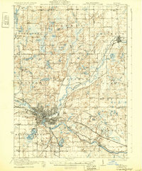
1918 Map of Battle Creek
USGS Topo · Published 1932About this map
The confluence of the Kalamazoo River and Battle Creek anchors this early twentieth-century portrait of Michigan's south-central industrial and agricultural interior. The urban grid of Battle Creek is shown in detail, including its transit links via the Michigan Central and Michigan Electric Railroad. Beyond the city, the landscape is defined by the glacial legacy of the region, dotted with numerous water bodies like Goguac Lake and St Marys Lake. A dense network of rural infrastructure reveals the era's educational and social priorities, with dozens of local landmarks such as the Little Brick School, Base Line Church, and Cobblestone School serving as community hubs. From the northern edge in Assyria and Bellevue to the village of Ceresco in the southeast, the map traces the early development of roads like Territorial Road and Base Line, illustrating how transportation and topography shaped the region's townships.
Find a feature on this map
104 named features on this map. Tap any name to fly to it.
Don’t see what you’re looking for? This feature index may not catch every label — zoom into the map to look around manually.
Map Details
Editions of this 1918 Battle Creek Map
4 editions found
Other maps of this area

1918 · Battle Creek
USGS Topo · 1:62,500

1918 · Union City
USGS Topo · 1:62,500

1918 · Galesburg
USGS Topo · 1:62,500

1918 · Leonidas
USGS Topo · 1:62,500

1921 · Marshall
USGS Topo · 1:62,500

1923 · Marshall
USGS Topo · 1:62,500

1943 · Battle Creek
USGS Topo · 1:62,500

1943 · Marshall
USGS Topo · 1:62,500

1944 · Leonidas
USGS Topo · 1:62,500

1944 · Galesburg
USGS Topo · 1:62,500