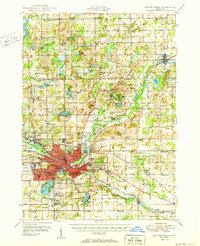
1950 Map of Battle Creek
USGS Topo · Published 1950About this map
Battle Creek serves as the industrial and transportation hub of this postwar landscape, defined by the convergence of the Michigan Central and Grand Trunk railroads. The urban core is surrounded by a dense network of suburban developments and institutional landmarks, including the Percy Jones Hospital and Kellogg Air Base. Beyond the city limits, the terrain transition into a rural mosaic of small farming communities like Bellevue, Verona, and Ceresco.
Find a feature on this map
111 named features on this map. Tap any name to fly to it.
Don’t see what you’re looking for? This feature index may not catch every label — zoom into the map to look around manually.
Map Details
Editions of this 1950 Battle Creek Map
3 editions found

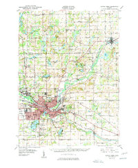
Other maps of this area

1918 · Battle Creek
USGS Topo · 1:62,500

1918 · Union City
USGS Topo · 1:62,500

1918 · Galesburg
USGS Topo · 1:62,500

1918 · Leonidas
USGS Topo · 1:62,500

1921 · Marshall
USGS Topo · 1:62,500

1923 · Marshall
USGS Topo · 1:62,500

1943 · Battle Creek
USGS Topo · 1:62,500

1943 · Marshall
USGS Topo · 1:62,500

1944 · Leonidas
USGS Topo · 1:62,500

1944 · Galesburg
USGS Topo · 1:62,500