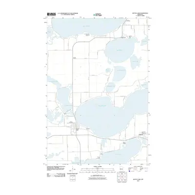
2010 Map of Battle Lake
USGS Topo · Published 2010About this map
The town of Battle Lake sits at the western edge of West Battle Lake, serving as a central hub for this lake-dense region of Otter Tail County. The map captures a well-developed recreation and residential landscape at the start of the 2010s, featuring numerous seasonal and year-round communities like Inglewood and Clitherall. Genealogists will find a high density of burial sites documenting the area's pioneer roots, including the Skibvedt Cemetery, Lakewood Cemetery, and the First Evangelical Lutheran Church Cemetery. The topography is defined by complex glacial hydrology, with the Otter Tail River flowing through Otter Tail Lake in the north and the Blanche Lake Dam controlling levels at Lake Blanche. Resorts such as the Woodland Beach Resort and Campground and Scenic Point Resort and Campgrounds underscore the area's long-standing identity as a destination for seasonal tourism and lakeside living.
Find a feature on this map
76 named features on this map. Tap any name to fly to it.
Don’t see what you’re looking for? This feature index may not catch every label — zoom into the map to look around manually.
Map Details
Editions of this 2010 Battle Lake Map
This is the sole edition of this map. No revisions or reprints were ever made.
Other maps of this area

1912 · Battle Lake
USGS Topo · 1:62,500

1913 · Ashby
USGS Topo · 1:62,500

1914 · Battle Lake
USGS Topo · 1:62,500

1915 · Underwood
USGS Topo · 1:62,500

1953 · Brainerd
USGS Topo · 1:250,000

1957 · Brainerd
USGS Topo · 1:250,000

1958 · Brainerd
USGS Topo · 1:250,000

1965 · Brainerd
USGS Topo · 1:250,000

1969 · Eagle Lake
USGS Topo · 1:24,000
1969 · Inspiration Peak
USGS Topo · 1:24,000
Featured Places
- Battle Lake, MN
- Clitherall, MN
- Everts Township, MN
- Clitherall Lake Mobile Home Park, Clitherall
- Clitherall Township, MN