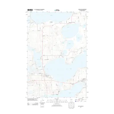
2013 Map of Battle Lake
USGS Topo · Published 2013About this map
W Battle Lake and Clitherall Lake dominate this portion of the Otter Tail County lake country, where the city of Battle Lake serves as a central hub for transportation and recreation. The landscape is defined by its glacial history, with numerous smaller bodies of water like Lake Blanche, Molly Stark Lake, and Annie Battle Lake scattered across the terrain. For genealogists and local historians, the presence of five distinct burial grounds including Lakewood Cem, Mt Pleasant Cem, and the First Evangelical Lutheran Church Cem provides vital points of reference for tracing early families in the region. The infrastructure reflects a well-developed resort economy, visible through landmarks like the Battle Lake Municipal Airport, the Balmoral Golf Course, and seasonal destinations such as the Woodland Beach Resort and Campground. Local settlements such as Inglewood and Clitherall are connected by a network of state highways and country roads that skirt the winding shorelines.
Find a feature on this map
70 named features on this map. Tap any name to fly to it.
Don’t see what you’re looking for? This feature index may not catch every label — zoom into the map to look around manually.
Map Details
Editions of this 2013 Battle Lake Map
This is the sole edition of this map. No revisions or reprints were ever made.
Other maps of this area

1912 · Battle Lake
USGS Topo · 1:62,500

1913 · Ashby
USGS Topo · 1:62,500

1914 · Battle Lake
USGS Topo · 1:62,500

1915 · Underwood
USGS Topo · 1:62,500

1953 · Brainerd
USGS Topo · 1:250,000

1957 · Brainerd
USGS Topo · 1:250,000

1958 · Brainerd
USGS Topo · 1:250,000

1965 · Brainerd
USGS Topo · 1:250,000

1969 · Eagle Lake
USGS Topo · 1:24,000
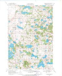
1969 · Inspiration Peak
USGS Topo · 1:24,000
Featured Places
- Battle Lake, MN
- Clitherall, MN
- Everts Township, MN
- Clitherall Lake Mobile Home Park, Clitherall
- Clitherall Township, MN