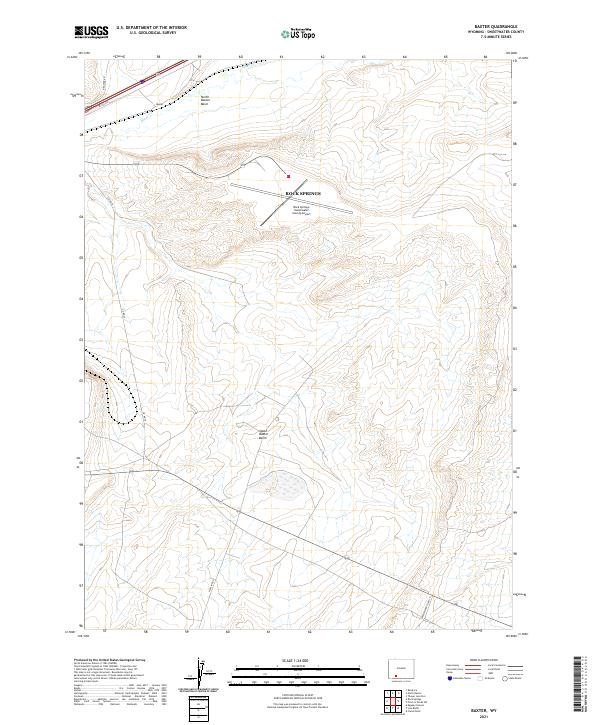
2021 Map of Baxter
USGS Topo · Published 2021About this map
North Baxter Basin and South Baxter Basin dominate this high-desert landscape east of Rock Springs. The area serves as a critical infrastructure corridor for southwestern Wyoming, anchored by the Rock Springs- Sweetwater County Airport and the small settlement of Baxter. The topographical layout reveals a network of industrial and utility routes, including Pipeline Rd and N Baxter Rd, which navigate the arid terrain carved by Bitter Cr. This survey illustrates the modern intersection of natural basin formations and the extensive logistics required for regional transit and energy distribution. The sparse distribution of named features reflects the open character of the high plains, where large-scale geological basins and critical transportation links define the human footprint.
Find a feature on this map
15 named features on this map. Tap any name to fly to it.
Don’t see what you’re looking for? This feature index may not catch every label — zoom into the map to look around manually.
Map Details
Editions of this 2021 Baxter Map
This is the sole edition of this map. No revisions or reprints were ever made.
Other maps of this area

1908 · Rock Springs
USGS Topo · 1:62,500

1910 · Rock Springs
USGS Topo · 1:62,500

1954 · Rock Springs
USGS Topo · 1:250,000

1958 · Rock Springs
USGS Topo · 1:250,000

1962 · Rock Springs
USGS Topo · 1:250,000

1968 · North Baxter
USGS Topo · 1:24,000

1968 · Point Of Rocks SW
USGS Topo · 1:24,000
1968 · Rock Springs
USGS Topo · 1:24,000
1968 · Reliance
USGS Topo · 1:24,000

1968 · Camel Rock
USGS Topo · 1:24,000