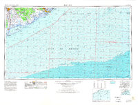
1974 Map of Bay City
USGS Topo · Published 1978About this map
Bay City and the surrounding coastal prairies are defined by the winding course of the Colorado River and the extensive marshlands of the San Bernard National Wildlife Refuge. This mid-1970s perspective shows the delicate geography of the Matagorda Peninsula, separating East Matagorda Bay from the open Gulf of Mexico. The map documents the industrial and transit footprint of the era, including the Missouri Pacific and Atchison Topeka and Santa Fe railroad lines that connected the interior to the coast. Along the shoreline, small communities like Matagorda Beach and Sargent sit near expansive wetlands and lakes such as Cow Trap Lake and Cedar Lake. Deep-water features like Stetson Bank and Clay Bank illustrate the transition from the coastal wetlands to the underwater bathymetry of the Gulf shelf.
Find a feature on this map
32 named features on this map. Tap any name to fly to it.
Don’t see what you’re looking for? This feature index may not catch every label — zoom into the map to look around manually.
Map Details
Editions of this 1974 Bay City Map
This is the sole edition of this map. No revisions or reprints were ever made.
Other maps of this area

1933 · San Luis Pass
USGS Topo · 1:31,680

1943 · San Luis Pass
USGS Topo · 1:31,680

1943 · Oyster Creek
USGS Topo · 1:31,680

1943 · Jones Creek
USGS Topo · 1:31,680

1943 · Freeport
USGS Topo · 1:31,680

1943 · Cedar Lakes East
USGS Topo · 1:24,000

1943 · Christmas Point
USGS Topo · 1:24,000

1943 · Snipe
USGS Topo · 1:31,680

1950 · Corpus Christi
USGS Topo · 1:250,000

1950 · Houston
USGS Topo · 1:250,000