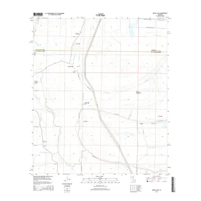
2015 Map of Bayou Jack
USGS Topo · Published 2015About this map
The boundary between Avoyelles Parish and St. Landry Parish cuts through this landscape of the Atchafalaya basin, where water dictates the settlement patterns. Small communities like Nugent, Bayou Jack, and Taterville are linked by Potatoeville Rd and Levee Rd, the latter running parallel to the complex waterway network. The geography is defined by numerous winding channels, including Alabama Bayou, Trevassar Bayou, and Jims Bayou, which flow through the West Atchafalaya Floodway. For genealogists, the map identifies several local burial sites, such as Spring Bluff Cem near Spring Bluff, Mount Olive Cem, and the Apostolic Cem. The map's detail shows how residents adapted to the wet terrain of the Prairie Du Bayou Rouge, with plantation roads like Moncrief Plantation Ln extending into the flood-prone lowlands near Keller Lake.
Find a feature on this map
46 named features on this map. Tap any name to fly to it.
Don’t see what you’re looking for? This feature index may not catch every label — zoom into the map to look around manually.
Map Details
Editions of this 2015 Bayou Jack Map
This is the sole edition of this map. No revisions or reprints were ever made.
Other maps of this area

1939 · Opelousas
USGS Topo · 1:62,500

1948 · Bunkie
USGS Topo · 1:62,500

1952 · Lake Charles
USGS Topo · 1:250,000

1954 · Lake Charles
USGS Topo · 1:250,000

1954 · Baton Rouge
USGS Topo · 1:250,000

1955 · Odenburg
USGS Topo · 1:62,500

1956 · Opelousas
USGS Topo · 1:62,500

1956 · Baton Rouge
USGS Topo · 1:250,000

1957 · Opelousas
USGS Topo · 1:62,500

1959 · Palmetto
USGS Topo · 1:62,500