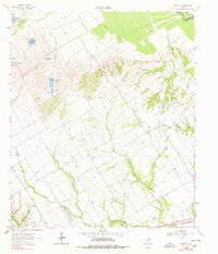
1962 Map of Bazette
USGS Topo · Published 1978About this map
Bazette and the surrounding Navarro County countryside appear as a landscape of rural activity and water management in this early 1960s survey. The area is defined by a series of engineered water bodies, including Reservoir No 9 and Reservoir No 7, while the Trinity River marks the northern boundary between Navarro and Henderson counties. The petroleum industry is clearly established here, with scattered Oil Wells and a significant Pipeline network cutting across the terrain.
Find a feature on this map
28 named features on this map. Tap any name to fly to it.
Don’t see what you’re looking for? This feature index may not catch every label — zoom into the map to look around manually.
Map Details
Editions of this 1962 Bazette Map
2 editions found
Other maps of this area

1920 · Kemp
USGS Topo · 1:62,500

1954 · Dallas
USGS Topo · 1:250,000

1957 · Kemp
USGS Topo · 1:62,500

1958 · Dallas
USGS Topo · 1:250,000

1959 · Powell
USGS Topo · 1:24,000

1960 · Tool
USGS Topo · 1:24,000

1960 · Goodlow Park
USGS Topo · 1:24,000

1961 · Kerens
USGS Topo · 1:24,000

1961 · Chatfield
USGS Topo · 1:24,000

1962 · Bazette
USGS Topo · 1:24,000