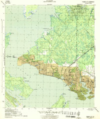
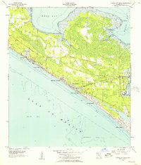
1956 Map of Beacon Beach
USGS Topo · Published 1957About this map
Shell Island and Hurricane Island dominate the coastal barrier landscape in this mid-1950s survey of the Florida panhandle shoreline. The map documents a significant military footprint, with large portions of the land designated for Tyndall Air Force Base, including Camp Merrill and a substantial Restricted Area extending into the Gulf of Mexico. Historical settlements such as Cromanton and Beacon Beach are visible along the northern shore of the barrier peninsula, providing a record of local habitation before further coastal development. The eastern side of the quadrangle includes Marywood Cem and the intricate coastal inlets of Pearl Bayou and Freshwater Bayou. At the western edge, the entrance channel leads toward St Andrews State Park, a key landmark that anchors the protection of this shifting sandy terrain.
Find a feature on this map
20 named features on this map. Tap any name to fly to it.
Don’t see what you’re looking for? This feature index may not catch every label — zoom into the map to look around manually.
Map Details
Editions of this 1956 Beacon Beach Map
2 editions found
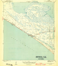
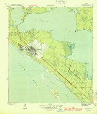
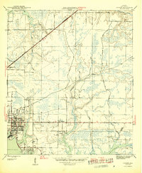
Other maps of this area

1943 · Beacon Beach
USGS Topo · 1:31,680
1943 · Panama City
USGS Topo · 1:31,680

1943 · Crooked Island
USGS Topo · 1:31,680
1943 · Panama City Beach
USGS Topo · 1:31,680
1944 · Long Point
USGS Topo · 1:31,680
1945 · Parker
USGS Topo · 1:31,680

1949 · Apalachicola
USGS Topo · 1:250,000

1954 · Tallahassee
USGS Topo · 1:250,000
1955 · Panama City Beach
USGS Topo · 1:24,000
1956 · Long Point
USGS Topo · 1:24,000
Featured Places
- Beacon Beach, FL
- Felix Lake, FL
- Redfish Point Extension, FL
- Redfish Point Housing, FL
- Sabre Palms Housing, FL