
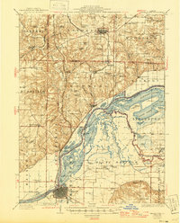
1926 Map of Beardstown
USGS Topo · Published 1926About this map
Beardstown serves as the rail and river hub for this portion of the Illinois River valley during the mid-1920s. The town sits at a strategic junction where the Chicago Burlington and Quincy RR crosses the Sangamon River just before its confluence with the Illinois River at Muscooten Bay. This environment is defined by an intricate network of bottomland lakes and sloughs, including Crane Lake, Stewart Lake, and Hickory Slough, reflecting a landscape deeply shaped by seasonal water movement.
Find a feature on this map
98 named features on this map. Tap any name to fly to it.
Don’t see what you’re looking for? This feature index may not catch every label — zoom into the map to look around manually.
Map Details
Editions of this 1926 Beardstown Map
2 editions found
Other maps of this area

1912 · Macomb
USGS Topo · 1:62,500

1914 · Macomb
USGS Topo · 1:62,500

1918 · Vermont
USGS Topo · 1:62,500

1921 · Vermont
USGS Topo · 1:62,500

1923 · Rushville
USGS Topo · 1:62,500

1925 · Havana
USGS Topo · 1:62,500

1926 · Rushville
USGS Topo · 1:62,500

1928 · Meredosia
USGS Topo · 1:62,500

1929 · Arenzville
USGS Topo · 1:62,500

1930 · Chandlerville
USGS Topo · 1:62,500