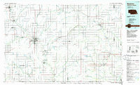
1986 Map of Beatrice
USGS Topo · Published 1986About this map
Homestead National Monument of America preserves the legacy of the pioneer era just west of Beatrice, marking a landscape where the Big Blue River and Big Nemaha River drain the rolling plains of southeast Nebraska. The mid-1980s landscape is defined by a dense grid of section lines and small agricultural settlements like Table Rock, Wilber, and Tecumseh. Transportation networks show the enduring influence of the Union Pacific and Burlington Northern railroads, which connect grain hubs like Wymore and Blue Springs. Numerous wildlife management areas, including Burchard Lake State Wildlife Management Area and Rockford State Wildlife Management Area, provide insight into the conservation of the prairie and riparian corridors in Gage and surrounding counties during this period.
Find a feature on this map
109 named features on this map. Tap any name to fly to it.
Don’t see what you’re looking for? This feature index may not catch every label — zoom into the map to look around manually.
Map Details
Editions of this 1986 Beatrice Map
2 editions found
Other maps of this area

1888 · Hiawatha
USGS Topo · 1:125,000

1889 · Seneca
USGS Topo · 1:125,000

1889 · Marysville
USGS Topo · 1:125,000

1893 · Washington
USGS Topo · 1:125,000

1894 · Seneca
USGS Topo · 1:125,000

1894 · Hiawatha
USGS Topo · 1:125,000

1894 · Marysville
USGS Topo · 1:125,000

1897 · Lincoln
USGS Topo · 1:125,000

1903 · Weeping Water
USGS Topo · 1:125,000

1907 · Nebraska City
USGS Topo · 1:62,500