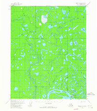
1956 Map of Beaver A-5
USGS Topo · Published 1965About this map
Stevens Village serves as the primary settlement on this interior Alaskan landscape, situated along the north bank of the Yukon River. The community's local infrastructure is detailed through its Landing Strip and a nearby Cem, indicating the established presence of this riverfront village. The topography is defined by an intricate network of waterways and wetlands, where the Little Dall River meanders south toward the Yukon valley, joined by tributaries such as Pat Creek and The Forks.
Find a feature on this map
22 named features on this map. Tap any name to fly to it.
Don’t see what you’re looking for? This feature index may not catch every label — zoom into the map to look around manually.
Map Details
Editions of this 1956 Beaver A-5 Map
2 editions found
Other maps of this area

1945 · Livengood
USGS Topo · 1:250,000

1951 · Livengood
USGS Topo · 1:250,000

1951 · Beaver
USGS Topo · 1:250,000

1952 · Livengood D-5
USGS Topo · 1:63,360

1953 · Livengood D-4
USGS Topo · 1:63,360

1954 · Livengood D-4
USGS Topo · 1:63,360

1956 · Beaver A-5
USGS Topo · 1:63,360

1956 · Beaver B-5
USGS Topo · 1:63,360

1956 · Beaver
USGS Topo · 1:250,000

1956 · Beaver A-4
USGS Topo · 1:63,360