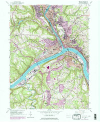
1953 Map of Beaver
USGS Topo · Published 1979About this map
The confluence of the Ohio River and Beaver River dictates the landscape of this industrial river corridor, where steep hillsides overlook a dense network of rail and river commerce. This mid-century survey reveals the tightly packed residential and civic cores of Beaver, New Brighton, and Rochester, which grew along these waterways. Cultural and educational institutions are prominent, from the Pennsylvania State University (Beaver Campus) to local landmarks like the Courthouse and Passavant Memorial Homes.
Find a feature on this map
91 named features on this map. Tap any name to fly to it.
Don’t see what you’re looking for? This feature index may not catch every label — zoom into the map to look around manually.
Map Details
Editions of this 1953 Beaver Map
4 editions found
Other maps of this area

1901 · Beaver
USGS Topo · 1:62,500

1902 · New Castle
USGS Topo · 1:62,500

1904 · Newcastle
USGS Topo · 1:62,500

1904 · Beaver
USGS Topo · 1:62,500

1906 · Sewickley
USGS Topo · 1:62,500

1908 · Sewickley
USGS Topo · 1:62,500

1908 · Zelienople
USGS Topo · 1:62,500

1910 · Zelienople
USGS Topo · 1:62,500

1951 · Canton
USGS Topo · 1:250,000

1953 · Canton
USGS Topo · 1:250,000