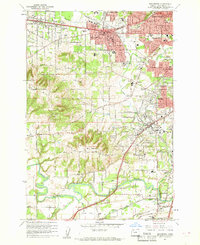
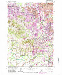
1961 Map of Beaverton
USGS Topo · Published 1961About this map
Beaverton and its surrounding communities are documented here in the early 1960s, showing a suburban landscape still intertwined with rural edges and institutional landmarks. The area is characterized by a dense network of schools and churches, such as St Marys Boys Home and the Merle Davies Sch, alongside local leisure sites like the Portland Hunt Club and Tualatin Country Club. The topography is dominated by the heights of Bull Mountain and Sexton Mtn, while the Tualatin River meanders across the southern portion of the sheet. Transportation is defined by the Southern Pacific and Oregon Electric railroads, which helped shape the growth of settlements like Tigard, Aloha, and Raleigh Hills. Small-scale industry is present through scattered quarries and a gravel pit near Durham, signaling the ongoing development of Washington County.
Find a feature on this map
83 named features on this map. Tap any name to fly to it.
Don’t see what you’re looking for? This feature index may not catch every label — zoom into the map to look around manually.
Map Details
Editions of this 1961 Beaverton Map
5 editions found
Other maps of this area

1897 · Portland
USGS Topo · 1:62,500

1905 · Portland
USGS Topo · 1:62,500

1914 · Oregon City
USGS Topo · 1:62,500

1915 · Hillsboro
USGS Topo · 1:62,500

1916 · Tualatin
USGS Topo · 1:62,500

1918 · Hillsboro
USGS Topo · 1:62,500

1939 · Oregon City
USGS Topo · 1:62,500

1939 · Tualatin
USGS Topo · 1:62,500

1940 · Tualatin
USGS Topo · 1:62,500

1940 · Hillsboro
USGS Topo · 1:62,500