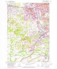
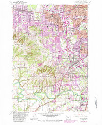
1961 Map of Beaverton
USGS Topo · Published 1977About this map
Beaverton and the surrounding hillsides show a period of transition in the mid-1970s, as established agriculture and quarries met expanding suburban development. The landscape is defined by its topographic high points, including Cooper MTN, Sexton Mtn, and Bull Mountain, while the Tualatin River winds through the southern lowlands. Local institutional history is anchored by St Marys Boys Home and numerous parochial schools like St Cecilias Sch. Transportation corridors follow historic routes, with the Southern Pacific and Oregon Electric lines crossing the terrain. The map records several family-named landmarks and infrastructure such as the Schamberg Bridge and ELSNER Bridge, alongside industry markers like the Cipole Gravel Pit near Onion Flat.
Find a feature on this map
66 named features on this map. Tap any name to fly to it.
Don’t see what you’re looking for? This feature index may not catch every label — zoom into the map to look around manually.
Map Details
Editions of this 1961 Beaverton Map
5 editions found
Other maps of this area

1897 · Portland
USGS Topo · 1:62,500

1905 · Portland
USGS Topo · 1:62,500

1914 · Oregon City
USGS Topo · 1:62,500

1915 · Hillsboro
USGS Topo · 1:62,500

1916 · Tualatin
USGS Topo · 1:62,500

1918 · Hillsboro
USGS Topo · 1:62,500

1939 · Oregon City
USGS Topo · 1:62,500

1939 · Tualatin
USGS Topo · 1:62,500

1940 · Tualatin
USGS Topo · 1:62,500

1940 · Hillsboro
USGS Topo · 1:62,500