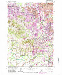
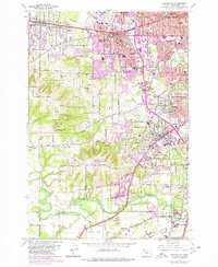
1961 Map of Beaverton
USGS Topo · Published 1985About this map
Beaverton and the surrounding Washington County landscape appear at a moment of significant postwar expansion, where purple-tinted urban extensions press against established landmarks like St Marys Boys Home and the Portland Hunt Club. The terrain transitions from the residential hills of West Slope and Raleigh Hills to the fertile bottomlands near the Tualatin River. Transportation networks define the area, with the Southern Pacific and Oregon Electric railroads cutting through old crossroads like Huber and Metzger.
Find a feature on this map
63 named features on this map. Tap any name to fly to it.
Don’t see what you’re looking for? This feature index may not catch every label — zoom into the map to look around manually.
Map Details
Editions of this 1961 Beaverton Map
5 editions found
Other maps of this area

1897 · Portland
USGS Topo · 1:62,500

1905 · Portland
USGS Topo · 1:62,500

1914 · Oregon City
USGS Topo · 1:62,500

1915 · Hillsboro
USGS Topo · 1:62,500

1916 · Tualatin
USGS Topo · 1:62,500

1918 · Hillsboro
USGS Topo · 1:62,500

1939 · Oregon City
USGS Topo · 1:62,500

1939 · Tualatin
USGS Topo · 1:62,500

1940 · Tualatin
USGS Topo · 1:62,500

1940 · Hillsboro
USGS Topo · 1:62,500