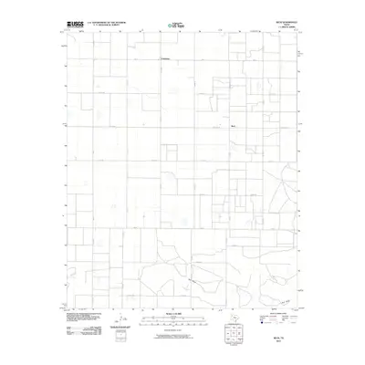
2010 Map of Beck
USGS Topo · Published 2010About this map
The settlement of Friendship and the agricultural hub of Beck anchor this 2010 survey of Lamb County, Texas. This High Plains landscape is defined by a rigorous grid of section-line roads, such as Co Rd 65 and Co Rd 75, which partition the vast cotton and grain fields typical of the Llano Estacado. The intersection of Beck Gin Rd and Fm 303 marks a central point in the local farming economy, while Fm 37 and Fm 54 serve as primary east-west corridors.
Find a feature on this map
21 named features on this map. Tap any name to fly to it.
Don’t see what you’re looking for? This feature index may not catch every label — zoom into the map to look around manually.
Map Details
Editions of this 2010 Beck Map
This is the sole edition of this map. No revisions or reprints were ever made.
Other maps of this area

1954 · Clovis
USGS Topo · 1:250,000

1954 · Brownfield
USGS Topo · 1:250,000

1958 · Brownfield
USGS Topo · 1:250,000

1958 · Clovis
USGS Topo · 1:250,000

1962 · Brownfield
USGS Topo · 1:250,000

1962 · Needmore
USGS Topo · 1:24,000

1962 · Amherst
USGS Topo · 1:24,000

1962 · Sudan
USGS Topo · 1:24,000

1964 · Oklahoma Flat
USGS Topo · 1:24,000
1964 · Bull Lake
USGS Topo · 1:24,000