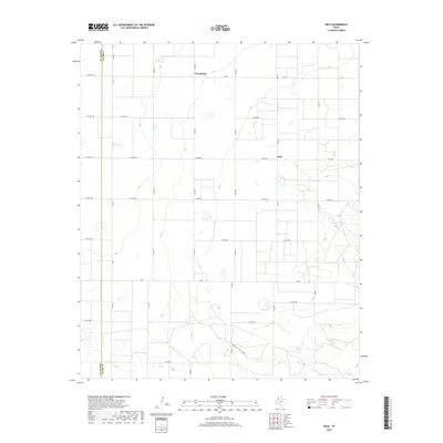
2019 Map of Beck
USGS Topo · Published 2019About this map
The agrarian landscape of the High Plains unfolds along the border of Bailey and Lamb counties, characterized by a dense grid of rural corridors and scattered depressions. Small settlements like Friendship and Beck serve as anchors for the surrounding farmsteads, connected by a network of Farm to Market roads including Fm 37 and Fm 303. The topography is largely uniform, punctuated primarily by the drainage of Bull Draw in the southern portion of the quadrangle. This 2019 survey documents the enduring layout of the Texas Panhandle's section-line road system, where nearly every mile is accessible via routes such as Co Rd 65 and Co Rd 272. The map illustrates a highly organized agricultural geography where water management and road access define the placement of local homesteads and crossroads communities.
Find a feature on this map
27 named features on this map. Tap any name to fly to it.
Don’t see what you’re looking for? This feature index may not catch every label — zoom into the map to look around manually.
Map Details
Editions of this 2019 Beck Map
This is the sole edition of this map. No revisions or reprints were ever made.
Other maps of this area

1954 · Clovis
USGS Topo · 1:250,000

1954 · Brownfield
USGS Topo · 1:250,000

1958 · Brownfield
USGS Topo · 1:250,000

1958 · Clovis
USGS Topo · 1:250,000

1962 · Brownfield
USGS Topo · 1:250,000

1962 · Needmore
USGS Topo · 1:24,000

1962 · Amherst
USGS Topo · 1:24,000

1962 · Sudan
USGS Topo · 1:24,000

1964 · Oklahoma Flat
USGS Topo · 1:24,000
1964 · Bull Lake
USGS Topo · 1:24,000