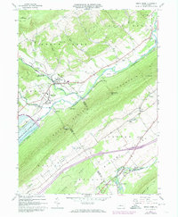
1967 Map of Beech Creek
USGS Topo · Published 1973About this map
Bald Eagle Mountain and Lamar Mountain define the valley corridors of this 1967 survey, where industrial and agricultural life centers on the confluence of Beech Creek and Eagle Creek. The landscape is dominated by the newly formed Foster Joseph Sayers Lake and its corresponding Foster Joseph Sayers Dam, a massive infrastructure project that altered the local hydrology. Local commerce and transit are anchored by the Penn Central railroad, which services small settlements like Blanchard and Beech Creek. To the south, Lamar sits along the banks of Fishing Creek, featuring the Lamar National Fish Hatchery. The map documents a transition in land use, showing both the preservation within the Sproul State Forest and active extraction sites like the Gravel Pit and various Quarries scattered across the limestone valleys.
Find a feature on this map
56 named features on this map. Tap any name to fly to it.
Don’t see what you’re looking for? This feature index may not catch every label — zoom into the map to look around manually.
Map Details
Editions of this 1967 Beech Creek Map
3 editions found
Other maps of this area

1921 · Howard
USGS Topo · 1:48,000

1921 · Lock Haven
USGS Topo · 1:62,500

1923 · Howard
USGS Topo · 1:62,500

1923 · Lock Haven
USGS Topo · 1:62,500

1924 · Centre Hall
USGS Topo · 1:62,500

1929 · Centre Hall
USGS Topo · 1:62,500

1937 · Millheim
USGS Topo · 1:48,000

1941 · Millheim
USGS Topo · 1:62,500

1943 · Lewistown
USGS Topo · 1:125,000

1944 · Lock Haven
USGS Topo · 1:62,500