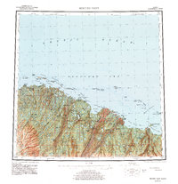
1960 Map of Beechey Point
USGS Topo · Published 1978About this map
The Sagavanirktok River and Kuparuk River dominate this coastal landscape of the North Slope during a period of transformative industrial development. While much of the terrain remains an intricate network of lakes and tundra streams, the emergence of Deadhorse and a Pumping station near Prudhoe Bay signals the early infrastructure of the Alaskan oil era. A Pipeline (Under construction) is shown snaking south from the coast, crossing the various forks of the Sagavanirktok. Along the shoreline, geographic features like Beechey Point and Milne Point anchor a complex system of lagoons and barrier islands, including the Jones Islands and Return Islands. Numerous Cabins are scattered across the coast, from Simpson Lagoon to Foggy Island, reflecting the sparse human presence in this remote Arctic environment before large-scale operations fully reshaped the region.
Find a feature on this map
64 named features on this map. Tap any name to fly to it.
Don’t see what you’re looking for? This feature index may not catch every label — zoom into the map to look around manually.
Map Details
Editions of this 1960 Beechey Point Map
3 editions found

Other maps of this area

1951 · Harrison Bay
USGS Topo · 1:250,000

1951 · Beechey Point
USGS Topo · 1:250,000

1951 · Sagavanirktok D-5
USGS Topo · 1:250,000

1951 · Mt. Michelson
USGS Topo · 1:250,000

1952 · Umiat
USGS Topo · 1:250,000

1955 · Flaxman Island
USGS Topo · 1:250,000

1955 · Harrison Bay
USGS Topo · 1:250,000

1955 · Beechey Point
USGS Topo · 1:250,000

1955 · Mount Michelson D-5
USGS Topo · 1:63,360

1955 · Harrison Bay C-1
USGS Topo · 1:63,360