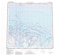
1960 Map of Beechey Point
USGS Topo · Published 1984About this map
Prudhoe Bay and the industrial activity of the North Slope Borough define this coastal Arctic landscape during a period of significant resource development. The map details the emergence of infrastructure centered around the Oil Field and the support hub at Deadhorse, connected by the vital Spine Road. This industrial corridor contrasts with the ancient water systems of the Kuparuk River and the braided Sagavanirktok River (Main Channel) that flow north into the Beaufort Sea.
Find a feature on this map
51 named features on this map. Tap any name to fly to it.
Don’t see what you’re looking for? This feature index may not catch every label — zoom into the map to look around manually.
Map Details
Editions of this 1960 Beechey Point Map
3 editions found

Other maps of this area

1951 · Harrison Bay
USGS Topo · 1:250,000

1951 · Beechey Point
USGS Topo · 1:250,000

1951 · Sagavanirktok D-5
USGS Topo · 1:250,000

1951 · Mt. Michelson
USGS Topo · 1:250,000

1952 · Umiat
USGS Topo · 1:250,000

1955 · Flaxman Island
USGS Topo · 1:250,000

1955 · Harrison Bay
USGS Topo · 1:250,000

1955 · Beechey Point
USGS Topo · 1:250,000

1955 · Mount Michelson D-5
USGS Topo · 1:63,360

1955 · Harrison Bay C-1
USGS Topo · 1:63,360