
1956 Map of Beeville
USGS Topo · Published 1956About this map
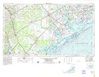
Coastal South Texas and the Brush Country are depicted during a period of significant military and industrial presence. The Matagorda Island Bombing and Gunnery Range occupies a prominent stretch of the barrier islands, while the Aransas National Wildlife Refuge preserves the marshes of the Blackjack Peninsula. Further inland, the landscape is defined by a dense network of oil fields and the major river systems of the Guadalupe River, San Antonio River, and Nueces River.
Find a feature on this map
157 named features on this map. Tap any name to fly to it.
Don’t see what you’re looking for? This feature index may not catch every label — zoom into the map to look around manually.
Map Details
Editions of this 1956 Beeville Map
2 editions found
Other maps of this area

1920 · Smiley
USGS Topo · 1:125,000

1920 · Mikeska
USGS Topo · 1:125,000

1920 · San Diego
USGS Topo · 1:62,500

1925 · Oakville No. 4
USGS Topo · 1:48,000

1925 · Mathis No. 2
USGS Topo · 1:48,000

1925 · Robstown
USGS Topo · 1:62,500

1925 · Aransas Pass
USGS Topo · 1:62,500

1925 · Mathis No. 3
USGS Topo · 1:48,000

1925 · Tordia No. 1
USGS Topo · 1:48,000

1925 · Corpus Christi
USGS Topo · 1:62,500