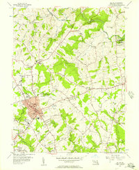
1956 Map of Bel Air
USGS Topo · Published 1957About this map
Bel Air serves as the focal point of this mid-1950s survey, showing the town's expansion along the Pennsylvania rail corridor. The community structure is well-defined by public and religious landmarks, including the Bel Air High Sch, a Po, and the Armory. To the north, the landscape is dotted with rural settlements and crossroads like Hickory and Sandy Hook, while the northern boundary is shaped by the winding course of Deer Creek.
Find a feature on this map
79 named features on this map. Tap any name to fly to it.
Don’t see what you’re looking for? This feature index may not catch every label — zoom into the map to look around manually.
Map Details
Editions of this 1956 Bel Air Map
4 editions found
Other maps of this area

1893 · Gunpowder
USGS Topo · 1:62,500

1898 · Tolchester
USGS Topo · 1:125,000

1900 · Havre De Grace
USGS Topo · 1:62,500

1900 · Betterton
USGS Topo · 1:62,500

1901 · Belair
USGS Topo · 1:62,500

1901 · Gunpowder
USGS Topo · 1:62,500

1903 · Tolchester
USGS Topo · 1:125,000

1908 · Tolchester
USGS Topo · 1:125,000

1941 · Gunpowder
USGS Topo · 1:62,500

1942 · Havre De Grace
USGS Topo · 1:62,500