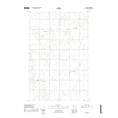
2017 Map of Belden
USGS Topo · Published 2017About this map
Belden serves as the primary focal point of this Mountrail County landscape, situated where Belden Rd meets the section line grid. This prairie terrain is defined by its agricultural layout, punctuated by a series of small wetlands and potholes typical of the region's glacially formed topography. For those researching local heritage, the map identifies significant communal landmarks such as Knife River Lutheran Cem in the northwestern quadrant and Bethany Cem further east. These sites, along with the systematically numbered routes like 57th St NW and 50th St NW, reflect the enduring township and range system that has organized the North Dakota plains since the era of homesteading.
Find a feature on this map
15 named features on this map. Tap any name to fly to it.
Don’t see what you’re looking for? This feature index may not catch every label — zoom into the map to look around manually.
Map Details
Editions of this 2017 Belden Map
This is the sole edition of this map. No revisions or reprints were ever made.
Other maps of this area

1953 · Williston
USGS Topo · 1:250,000

1957 · Williston
USGS Topo · 1:250,000

1969 · Stanley
USGS Topo · 1:24,000

1969 · Stanley SE
USGS Topo · 1:24,000

1981 · Belden SW
USGS Topo · 1:24,000
1981 · Belden SE
USGS Topo · 1:24,000

1981 · Stanley SE
USGS Topo · 1:24,000

1981 · Palermo
USGS Topo · 1:24,000
1981 · Epworth
USGS Topo · 1:24,000
1981 · Epworth NW
USGS Topo · 1:24,000