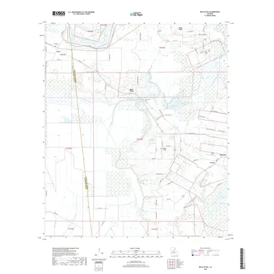
2018 Map of Belle d'Eau
USGS Topo · Published 2018About this map
The Red River defines the northern reaches of this landscape, its path reinforced by the Levee Rd as it flows past the community of Echo. The terrain is a complex network of wetlands and waterways, where the Coulée du Pêcheur and Bayou des Allemands carve through the prairie and woodland. Small settlements like Belle d'Eau, Les Grandes Côtes, and Norma are connected by a grid of local routes such as Ellis Mills Rd and Bordelon Rd, reflecting the rural agricultural character of the region.
Find a feature on this map
73 named features on this map. Tap any name to fly to it.
Don’t see what you’re looking for? This feature index may not catch every label — zoom into the map to look around manually.
Map Details
Editions of this 2018 Belle d'Eau Map
This is the sole edition of this map. No revisions or reprints were ever made.
Other maps of this area

1935 · Turkey Creek
USGS Topo · 1:62,500

1935 · Lecompte
USGS Topo · 1:62,500

1940 · Marksville
USGS Topo · 1:62,500

1948 · Bunkie
USGS Topo · 1:62,500

1949 · Turkey Creek
USGS Topo · 1:62,500

1952 · Lake Charles
USGS Topo · 1:250,000

1953 · Alexandria
USGS Topo · 1:250,000

1954 · Lake Charles
USGS Topo · 1:250,000

1955 · Alexandria
USGS Topo · 1:250,000

1957 · Lecompte
USGS Topo · 1:62,500