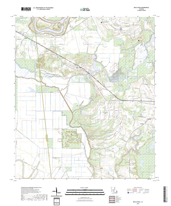
2024 Map of Belle d'Eau
USGS Topo · Published 2024About this map
The Red River sweeps across the northern reaches of this Avoyelles Parish landscape, where the alluvial plain is defined by a dense network of watercourses and protected wetlands. The Grand Cote National Wildlife Refuge dominates the eastern quadrant, preserving the bottomland character that historically shaped local settlement patterns. Small communities and named hamlets like Echo, Belle d'Eau, and Hessmer are linked by a grid of rural roads and parish lines, including the boundary between Rapides Parish and Avoyelles Parish.
Find a feature on this map
71 named features on this map. Tap any name to fly to it.
Don’t see what you’re looking for? This feature index may not catch every label — zoom into the map to look around manually.
Map Details
Editions of this 2024 Belle d'Eau Map
This is the sole edition of this map. No revisions or reprints were ever made.
Other maps of this area

1935 · Turkey Creek
USGS Topo · 1:62,500

1935 · Lecompte
USGS Topo · 1:62,500

1940 · Marksville
USGS Topo · 1:62,500

1948 · Bunkie
USGS Topo · 1:62,500

1949 · Turkey Creek
USGS Topo · 1:62,500

1952 · Lake Charles
USGS Topo · 1:250,000

1953 · Alexandria
USGS Topo · 1:250,000

1954 · Lake Charles
USGS Topo · 1:250,000

1955 · Alexandria
USGS Topo · 1:250,000

1957 · Lecompte
USGS Topo · 1:62,500