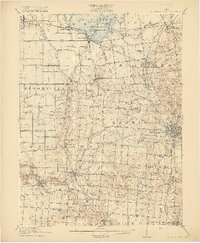
1915 Map of Bellefontaine
USGS Topo · Published 1915About this map
Indian Lake dominates the northern landscape of Logan County, characterized in the early twentieth century by its cluster of islands including Wolf Island, Orchard Island, and Crane Island. The rail infrastructure of this era is particularly dense, showing the Ohio Electric line and the St Marys Branch converging toward the regional hub of Bellefontaine. This county seat serves as a social center, anchored by the County Infirmary and the Childrens Home. Moving south and west, the terrain transitions into a grid of rural townships like Bloomfield and Pleasant, where numerous numbered schoolhouses and small settlements such as Logansville and Bloom Center reflect a decentralized agricultural community. The Miami River and its tributaries, including Muchinippi Creek and Buckongahelas Creek, carve through the landscape, providing the drainage that supported the area's productive farmsteads and the growing villages of Degraff and Quincy.
Find a feature on this map
103 named features on this map. Tap any name to fly to it.
Don’t see what you’re looking for? This feature index may not catch every label — zoom into the map to look around manually.
Map Details
Editions of this 1915 Bellefontaine Map
3 editions found
Other maps of this area

1906 · Lima
USGS Topo · 1:62,500

1913 · Alger
USGS Topo · 1:48,000

1913 · Bellefontaine
USGS Topo · 1:48,000

1913 · Sidney
USGS Topo · 1:62,500

1913 · East Liberty
USGS Topo · 1:62,500

1914 · Troy
USGS Topo · 1:62,500

1914 · St. Paris
USGS Topo · 1:62,500

1914 · Mechanicsburg
USGS Topo · 1:62,500

1915 · Alger
USGS Topo · 1:62,500

1915 · Bellefontaine
USGS Topo · 1:62,500